|
|
New Providence Amateur Radio Club |
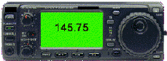
Club Simplex Frequency:
|
|
|
New Providence Amateur Radio Club |
Club Simplex Frequency:
|
Menu:
ARRL Web Sites:Solar Conditions:
page last modified: Thu Oct 7 06:30:18 2021 PT |
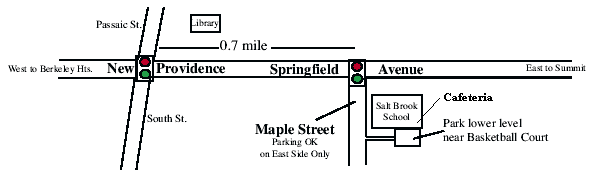
Driving Directions to the Salt Brook SchoolGPS coordinates: 40 42' 27" and -74 23' 25" (or 40 42.470' and -74 23.420') The Salt Brook School is at 40 Maple Street, New Providence, NJ -- near the intersection of Maple and Springfield Ave. All activities are held in the school cafeteria. Enter through doors on right far corner of building near outdoor basketball courts. Parking is available in the front of the school or in the right lower level parking lot after school hours. Also on Maple St., school side of the street only.
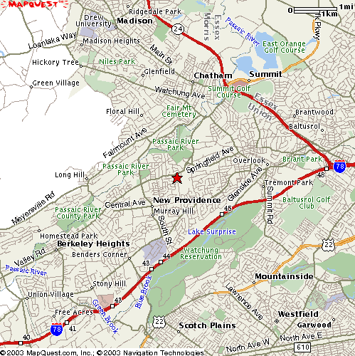
Map of general New Providence area
From West via Interstate 78 Eastbound: Take exit 44. At the bottom of the exit ramp, turn left onto Glenside Avenue. Go about 1/4 mile and look for your first left, Glenside Road, which goes under Route 78. Go straight at the next light as Glenside turns into South Street. Go two more lights to the center of New Providence and turn right on Springfield Avenue. Go 0.7 miles to next light and turn right on Maple Street. The school is just up on the left. From East via Interstate 78 Westbound: Take exit 43. Ramp leads right onto Diamond Hill Road. Go through the second light (Mountain Avenue) as the road becomes Union Road. Go down the hill to the next light (T intersection; with McDonalds) and turn right onto Springfield Avenue. Go about 1.8 miles to third light and turn right on Maple Street. The school is just up on the left. Locally from the East or North (Summit): Take Route 24 to Summit and the Broad Street exit. Follow Broad St west about a mile and then turn right at light onto Springfield Avenue (Rt 512). Follow Springfield Avenue through Summit and south to New Providence (about 2 miles). Turn left at traffic light for Maple Street. School is just up on the left. Locally from the South (Rt. 22 and Scotch Plains): From Route 22, take Diamond Hill Road (Snuffy's/Blue Star Shopping Center) north through the light at Mountain Avenue. The road becomes Union Road. Go down the hill to the next light (T intersection; with McDonalds) and turn right onto Springfield Avenue. Go about 1.8 miles to third light and turn right on Maple Street. The school is just up on the left. Locally from the West (Berkeley Heights): Follow Springfield Avenue east through the traffic light in the center of New Providence at South Street for another 0.7 mile to light at Maple Street. Turn right onto Maple Street and the school is just up on the left.
|